

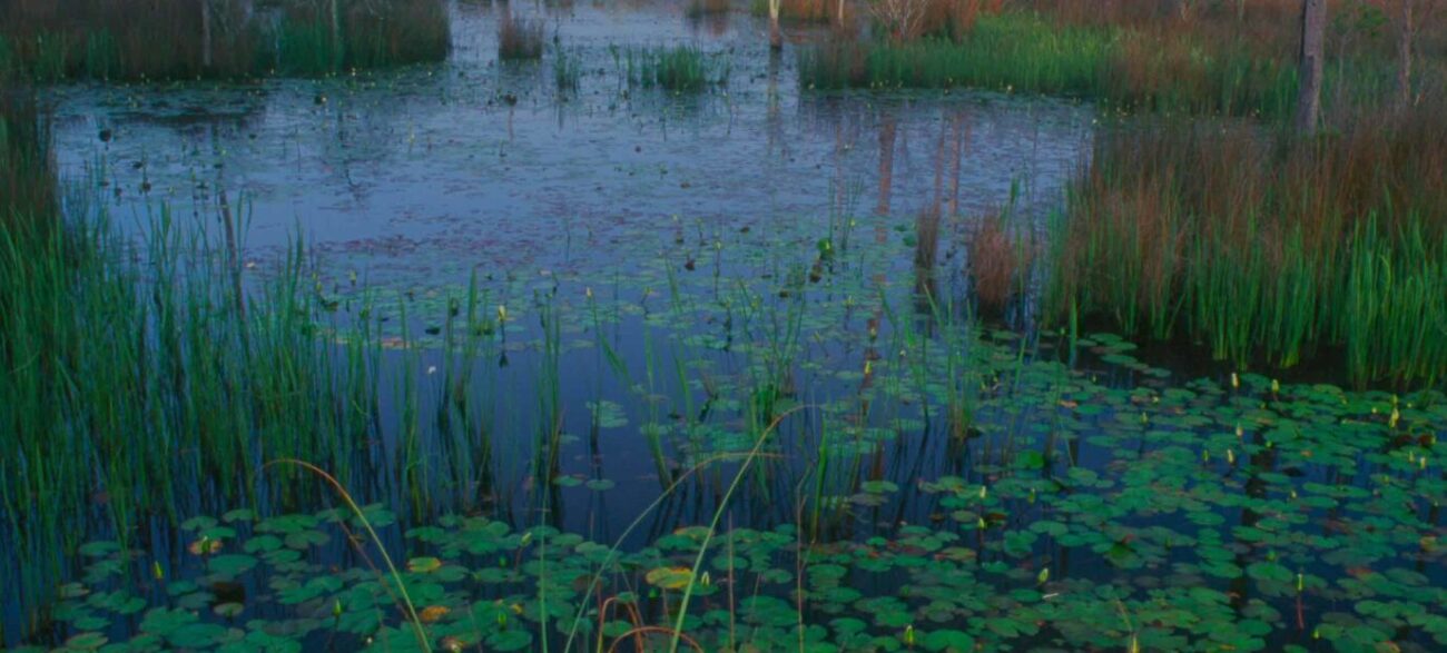
Big Branch Marsh National Wildlife Refuge protects more than 18,000 acres along the north shore of Lake Pontchartrain, and the water is the best way to see most of it.
The refuge exists because people fought for it. A group of residents worried about how fast the Northshore was being developed pushed for federal protection in the early 1990s, and the Fish and Wildlife Service began acquiring land in 1994. The original 12,000 acres have grown to nearly 19,000, making this the largest undeveloped natural area on the lake’s northern edge. The land steps down through habitat types as it approaches the water, starting in pine savanna, running through hardwood hammocks and bald cypress-tupelo forest, and finishing in freshwater and brackish marsh.
Check conditions before loading the kayak. Tropical Storm Arthur pushed through southeast Louisiana this summer and dropped a pine tree through the pavilion at the Lemieux Center, along with downed trees and branches across the trails at that site. Fish and Wildlife has it closed until further notice while crews assess damage and clear debris. Call refuge headquarters at (985) 882-2000 for the current status of other access points.
Paddlers have several ways in. The free public launch on Lake Road puts boats directly onto Bayou Lacombe, with an information kiosk and an observation deck looking out over the lake. The Sapsucker Road launch sits off Paquet Road down a half mile of gravel, and gasoline motors are prohibited there, so the water stays quiet for anyone in a kayak or canoe. From that launch, a straight boat lane runs roughly two miles to Lake Pontchartrain, with side channels branching off into the marsh for anyone who wants to wander.
Cane Bayou is the other classic route. It forms the boundary between the refuge and Fontainebleau State Park, with the state park on one bank and refuge marsh on the other. The paddle starts in piney uplands, passes beneath a century-old railroad trestle now carrying the Tammany Trace, and reaches the lake in about two miles. There are no facilities at the put-in, and the parking area rarely sits empty even on weekdays.
Bird activity along these waterways stays heavy year-round. Wading birds and seabirds commute between the marsh and the lake all day, so snowy egrets, tricolored herons, little blue herons, and green herons are routine sightings. Caspian, royal, black, and sandwich terns work the open water, and black skimmers nest in the area. River otters live here too. Anglers pull bass, bream, catfish, and speckled trout from these waters with a valid Louisiana fishing license.
Anyone who wants dry land should head for the Boy Scout Road trails. The route opens with a half-mile self-guided boardwalk. At the end, walkers can loop back to the lot or continue on a four-mile round trip over dirt and gravel road that crosses pine savanna, passes a marsh overlook and oak cheniers, and finishes at the edge of Bayou Lacombe. This is the best place on the refuge to find the threatened red-cockaded woodpecker in spring and summer. Its call sounds like a dog’s squeaky toy, and nesting trees carry a painted white circle. Louisiana wild iris blooms in the roadside ditches in March and April.
The Bayou Lacombe Visitor Center at 61389 Highway 434 works as the front door to the whole Southeast Louisiana refuge complex, with exhibits, maps, and a nature store. It opens Thursday, Friday, and Saturday from 9 a.m. to 4 p.m. Trails behind the center wind past a pollinator garden, azalea paths, formal camellia gardens, and a small Redemptorist Order cemetery.
Admission is free, mosquitoes are not, so pack repellent and go early.