The Mississippi is the reason New Orleans exists, and the city has never fully turned its back on it. These five spots let you get close to the water on your own terms, from a quiet levee path across the river to an industrial wharf repurposed as public parkland. Each one shows you a different version of the same river.
Woldenberg Park
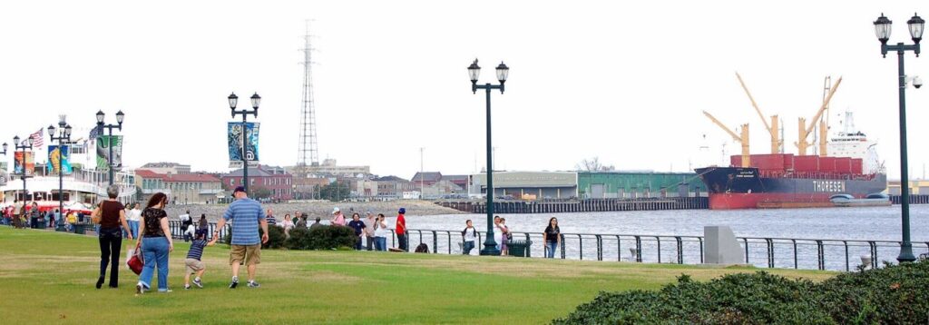
Most people’s first look at the Mississippi in New Orleans happens here without them realizing it. Woldenberg Park stretches along the riverfront just outside the French Quarter, from the Aquarium of the Americas downriver toward the edge of the CBD, and it puts you on the water at the exact point where the river makes its sharp bend.
That curve is why the city exists at all. Jean Baptiste LeMoyne chose this crescent of high ground in 1718 because it offered control of the river’s tightest turn, and from the park’s upper promenade, you can feel the logic of that decision. Tankers, container ships, tugboats pushing long strings of barges, and the occasional cruise ship all pass within close range. There are benches, open lawns, and a paved waterfront promenade running the length of the park. It’s open, uncrowded most mornings, and free.
The Moonwalk
Just upriver from Woldenberg, a set of wide concrete steps leads directly down to the river’s surface. The Moonwalk is named for former Mayor Moon Landrieu, who opened this stretch of public river access in the 1970s when most of the French Quarter waterfront was blocked by wharves and rail lines. The steps put you physically below street level and at the edge of the current, close enough to watch the brown water moving fast below you and feel the scale of the river in a way that the elevated promenade at Woldenberg doesn’t allow.
Street musicians often set up on the upper level. Locals come down here in the early morning before the Quarter wakes up. It’s the closest most people will get to the actual surface of the Mississippi without getting on a boat.
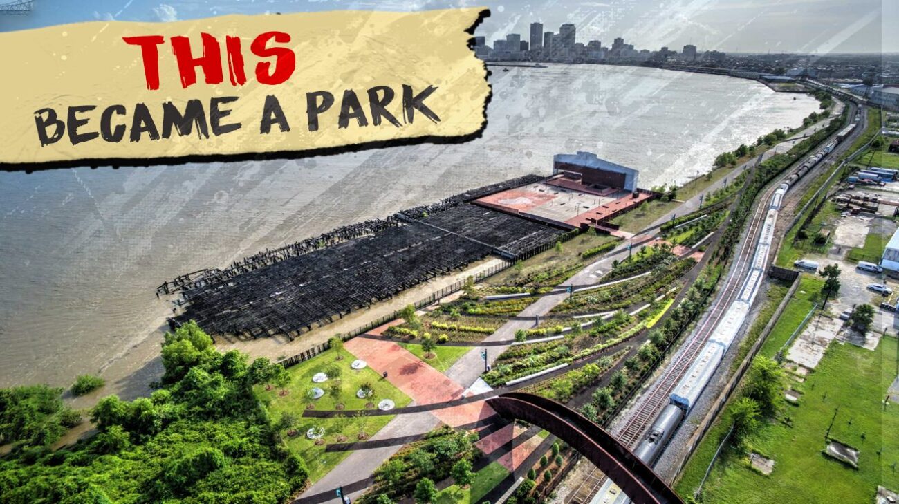
Crescent Park and the Mandeville Wharf
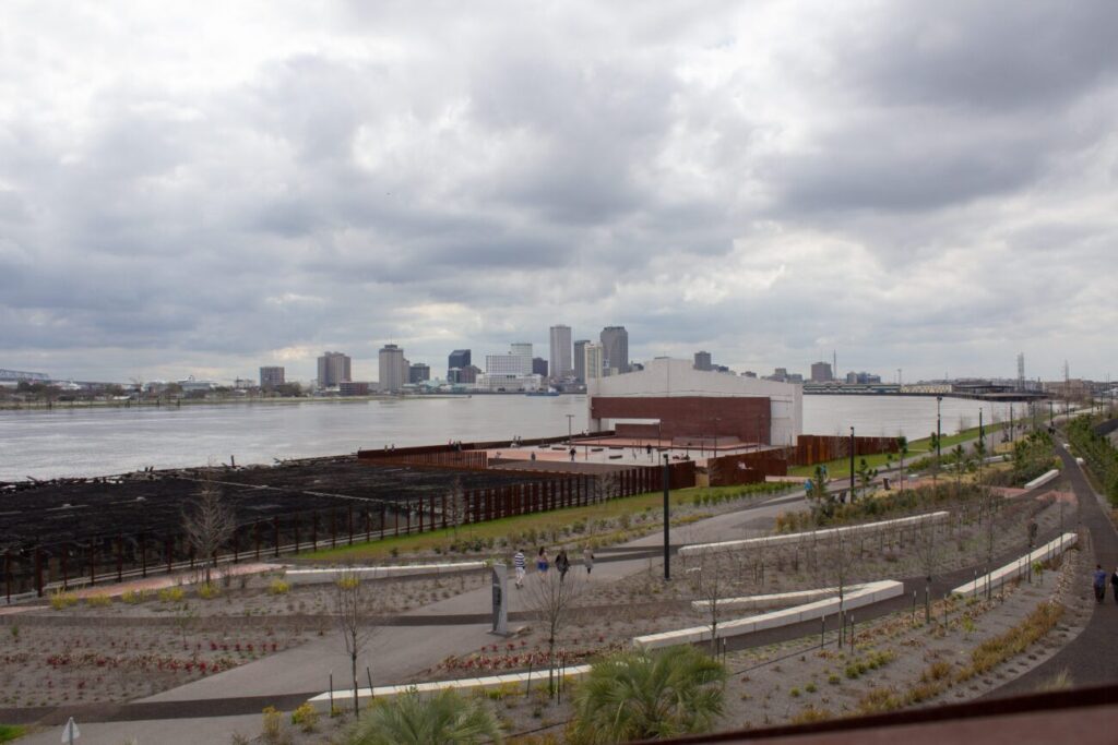
The design question behind Crescent Park was whether to erase the industrial history of the Bywater and Marigny waterfront or to build on top of it. The team behind the $31 million project, which included Tanzanian architect David Adjaye and Boston firm Hargreaves Associates, chose the latter. The paths follow the lines of defunct railroad spurs. Concrete slabs mark where the old streets once met the waterfront. The Mandeville Wharf, a 52,000-square-foot former industrial shed, still stands in its raw steel-and-concrete state, now used for community events and open-air gatherings.
The arched Piety Street Bridge carries pedestrians over the active rail line and flood wall that separated this neighborhood from its own river for decades. The park runs 1.4 miles from Elysian Fields Avenue to Mazant Street in the Bywater, with a dog run, picnic areas, and unobstructed views of the downtown skyline and the Crescent City Connection bridge. Enter from the Mazant Street ramp or the Elysian Fields entrance. Open daily; free.
The Fly at Audubon Park
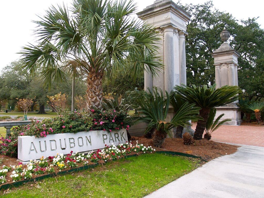
Nobody in New Orleans calls it Audubon Riverview Park. It’s the Fly, a name left over from a butterfly-shaped concrete river-viewing platform built in the 1960s and destroyed in the 1980s when a runaway barge took it out in the fog. What remains is a wide stretch of levee-top greenspace behind the Audubon Zoo in Uptown, and it’s been the city’s unofficial riverside living room for over 50 years.
The Fly draws a specific crowd: families with crawfish boils, college students with blankets, dog walkers, and anyone who wants to watch the sun go down over the water from a grass lawn with no admission charge and no crowds. The barges move slowly from up here; the river looks wide enough to be a lake, and the light at golden hour is worth planning around. The park is open daily from 5 a.m. to 10 p.m. Enter from Leake Avenue near the Audubon Zoo.
Algiers Point Levee Path
Getting here requires a $2 ferry ride from the foot of Canal Street, which is itself one of the better five minutes you can spend in New Orleans. The ferry has been crossing since 1827. On the Algiers side, a paved levee path stretches in both directions from the landing, with the downtown skyline and the twin spans of the Crescent City Connection directly across the water. The view of St. Louis Cathedral from this side is the one photographers use.
Walking downriver from the Algiers Point ferry landing, historical society plaques embedded in the pavement mark the sites of former plantations, railroad yards, and the holding area where newly arrived enslaved Africans were kept before being ferried across for auction.
Walking upriver takes you past the Robert E. Nims Jazz Walk of Fame, a line of lampposts each naming a jazz legend with a short biography. The neighborhood on either side is residential, quiet, and largely unknown to most visitors. Tankers pass so close to the levee path that you can read the names on their hulls. The ferry runs daily; check NORTA’s schedule at norta.com for current times.