

November at Zion means shuttle queues, parking-lot gridlock, and a crowd-to-canyon ratio that tips wilderness into theme park. Several hours southeast, a 12-mile desert gorge called Aravaipa Canyon runs gold and orange beneath a strict 50-person daily visitor cap — and most of those cottonwoods go unwitnessed.
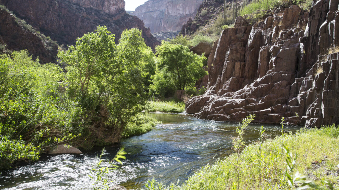
That’s the trade. Aravaipa delivers the drama — narrow red rock walls, a perennial creek, cottonwood and sycamore lit like something on fire — but it extracts a price. No trails. No signs. No facilities. Just the water, the canyon, and whatever gear was carried in.
Zion’s Scenery, None of the Infrastructure
Aravaipa Canyon Wilderness offers dramatic fall color and a strict 50-person daily limit, with zero hand-holding once visitors step inside.
The Bureau of Land Management characterizes the autumn landscape as brilliant red and golden foliage contrasting sharply with the surrounding Old West Sonoran Desert — and that contrast is the whole point. The canyon’s name, commonly translated from the Western Apache as “laughing waters,” fits. The creek is everywhere: hikers cross it repeatedly, sometimes knee-deep, over sand, gravel, and uneven cobble. The full west-to-east traverse covers 12.25 miles with about 430 feet of elevation gain. Backpackers often spread the route across one or two nights.
Peak foliage runs mid-November into early December — later than most U.S. destinations.
Before setting foot inside, the logistics:
- Permits are required and capped at 50 people per day, split between two trailheads. Book through Recreation.gov; the maximum stay is three days and two nights.
- The west trailhead is the more accessible option — reached from Arizona Route 77 via roughly nine miles of dirt road.
- The east trailhead is remote and unbridged, with creek crossings that are often impassable due to flash flooding. A high-clearance vehicle is necessary.
- Daytime highs in late fall typically sit in the low 70s°F. The creek runs around 50°F. Plan accordingly.
- Gear: waterproof or quick-dry footwear, neoprene socks, trekking poles — all strongly recommended for the terrain.
How to Actually Get There
Secure a Recreation.gov permit well ahead of November, as the 50-person daily cap can fill during peak foliage season.
The west trailhead is the more practical starting point for most visitors. Nine miles of dirt road lead to the canyon entrance; current road conditions should be confirmed before departure. From there, the canyon runs roughly east, and the creek becomes the route. That means repeated crossings in cold water — around 50°F. Wet boots arrive early. Trekking poles matter here: the cobble is slippery, the vegetation is dense, and there is no marked route to fall back on when the path becomes uncertain.
The place will test gear, navigation instincts, and tolerance for cold water. With 50 permitted visitors spread across a 12-mile wilderness, the crowds that define peak-season Zion simply do not follow. The foliage window is short, and the permit calendar moves faster than the cottonwoods drop their leaves.